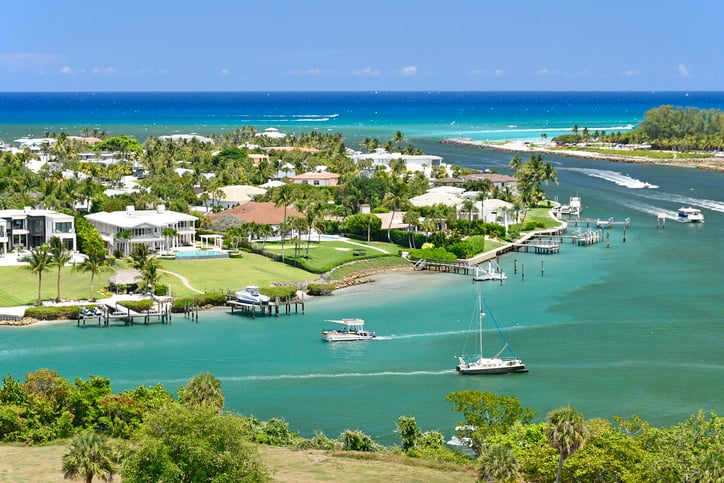
Two updates crossed the news cycle within days of each other this spring. One said the district's 2026 dredging project was finished, on schedule, sand placed where it belonged. The other showed a fishing boat nearly flipping sideways on a sandbar outside the inlet mouth, filmed by a captain who has been running that cut for fifteen years. Both were true. That gap between "the project is complete" and "the water is still doing this" is the thing worth understanding if you live anywhere near Jupiter Inlet Colony and put a boat in the water more than a few times a season.
The short version: the Jupiter Inlet District finished the work it was contracted to do. That project addressed the sand trap, not the outer shoal where boaters have encountered trouble.
What Actually Got Dredged This Year
The Jupiter Inlet District's 2026 Sand Trap Dredging and Beach Nourishment Project ran in two phases, from January 17 through February 15 and again from April 14 through April 26. Atlantic & Gulf Dredging pulled sand from the inlet's sand trap, a 6.58-acre basin sitting about 1,000 feet west of the inlet mouth, and pumped it onto the beach south of the inlet between two DEP survey monuments, R-13 and R-19.
Here's the number worth sitting with. Taylor Engineering's original project specs estimated somewhere between 100,000 and 120,000 cubic yards for bidding purposes. The district's completed-project figure came in around 176,000 cubic yards, roughly 50 to 75 percent more sand than the engineers planned for. That's not a rounding difference. It means whatever is feeding sediment into that trap is moving faster than the last engineering estimate accounted for, and the district ended up moving considerably more material than the budget assumed it would need to.
That matters for how you read the rest of this. The trap is filling faster than projected. The dredging completed in April addressed that specific, contracted problem. It did not touch the part of the inlet where boaters are actually getting into trouble.
Why the Outer Shoal Is Separate From the Sand Trap Project
The dangerous sandbar that made headlines this year sits outside the inlet mouth, on the ocean side, in what's called the ebb shoal. The Jupiter Inlet District's authority stops at the sand trap. It is not authorized to dredge the shoal outside the inlet, and it has said as much publicly.
The reason traces back to a designation most residents never think about. Jupiter Inlet is not a federally maintained navigation channel. Compare that to Lake Worth Inlet at the Port of Palm Beach, which the U.S. Army Corps of Engineers dredges and maintains directly because it carries that federal designation. Jupiter Inlet doesn't have it. The Corps has previously declined to establish one here based on its benefit-to-cost formula, though the district says it hopes to encourage a second look.
Without that designation, the inlet falls into what officials describe as a non-navigable inlet category, which sounds bureaucratic until you translate it: no single agency currently has both the authority and the mandate to fix the outer shoal. Col. Brandon Bowman of the Army Corps put it plainly in a WPTV interview this spring, saying the inlet is managed by the district and that the Corps is working closely with them on permits. Working on permits is not the same as dredging the shoal.
There's a second wrinkle. Some of the same beach nourishment sand the district is required to place on shore, the sand that protects the beach from erosion, gets pulled back into the inlet system when a strong swell rolls through. Captain Tyler Baruch, the Jupiter native whose video of a near-flip has drawn more than 400,000 views, has argued this directly, saying the dredging underway at the time was making the outer problem worse rather than better. Whether that's the full explanation or one piece of a larger sediment picture, it's the kind of tension that shows up when a fix for one stretch of coastline interacts with a completely different stretch a few hundred yards away.
How Local Captains Actually Read the Cut
Ask someone who's fished this inlet for decades how they handle it, and you get a method, not a map. Captain William Taylor of the Black Dog, who has worked out of Jupiter Inlet for more than 30 years, described his approach to Local10 and WPTV this spring.
"You have to check the waves every day to make sure the deep spot that was there yesterday is still there today."
His practical rule: wait for a bigger vessel to go out first, watch exactly where it tracks, and use that line to judge whether your own boat has the right draft to follow safely. The channel that worked Tuesday might not be the channel that works Thursday. That's not a knock on the district's work. It's simply how a shifting, unregulated ebb shoal behaves, and it's the operating knowledge that residents who've been here longest actually rely on instead of assuming a completed dredging cycle means a stable cut.
If you want a starting point before you're on the water, the Jupiter Inlet District keeps live views of the inlet along with tide charts and marine condition updates on its site. It won't tell you where today's deep spot is, but it's a reasonable first check before you trust yesterday's memory of the channel.
The Turtle Season Complication
Timing adds another layer. Florida's sea turtle nesting season runs through October 31, and beach placement of dredged sand has to work around it. Congressman Brian Mast referenced this directly when discussing why the district couldn't simply place additional sand on the beach once the outer sandbar problem became public knowledge, noting that officials had only days left before nesting season restrictions took effect.
That's a real constraint, not an excuse. It means any additional beach nourishment work tied to this issue likely won't happen until after nesting season closes at the end of October, which pushes any broader fix into next winter's dredging window at the earliest.
A Few Things Worth Doing This Season
- Check the Jupiter Inlet District's live camera and tide information before heading out, especially on days following a swell event
- If you're newer to the inlet or running a boat with a deeper draft, wait for a larger vessel to cross first and follow its line rather than guessing
- Treat any given week's "safe channel" as temporary. Conditions that held for days can shift with a single swell
- Keep in mind that the completed 2026 sand trap project addressed erosion into the inner basin, not the outer ebb shoal where the reported incidents have occurred
When the Water's Not Cooperating
Some days the smarter call is simply not going out, and Jupiter Inlet Colony sits close enough to Hobe Sound that a land-based alternative is a short drive rather than a plan. Blowing Rocks Preserve, at 574 South Beach Road, is 73 acres of Anastasia limestone shoreline that the Nature Conservancy has managed since Jupiter Island residents donated the land in 1969 rather than see it developed into apartments or a hotel. The preserve is open seven days a week from 9 a.m. to 4:30 p.m., admission is free with an optional two-dollar donation, and its short Beach Trail and Dune Trail, a tenth of a mile and four tenths of a mile respectively, both lead to stretches of shoreline where the exposed rock ledge is at its most dramatic during high tide with rough seas, typically a winter phenomenon rather than a summer one.
It won't replace a day on the water. It's a reasonable reminder that this stretch of coast has been worth protecting for longer than the current sandbar debate has existed, and that the same residents who fought off a hotel development in the 1960s are, in a sense, the same community now pushing officials to take the outer shoal seriously.
The Actual Takeaway
The 2026 dredging season did what it was supposed to do inside the sand trap, and did more of it than engineers expected. The outer shoal, where boaters have encountered trouble, was outside the project's scope. Knowing that difference, and knowing which captains' judgment to trust on a given morning, is the real local knowledge here. A completed dredging report describes work inside the sand trap; it does not establish that the outer shoal is stable.
If you're weighing what life on this stretch of water actually looks like day to day, from boating logistics to the neighborhoods that back right up to the inlet, Kristin Wallace has spent years working this exact corner of northern Palm Beach County. Let's Connect if you'd like a local read on any of it.
This article is general information, not legal, tax or financial advice. Consult a qualified professional about your situation.